


Construction and development
Accurate data for faster decisions
In construction and development projects, the current status, overview and evidence are decisive. AuditAir brings modern remote sensing, 3D documentation and accurate map outputs that help investors, designers, construction supervision and implementation teams work faster, safer and with greater confidence.
From initial area mapping, through ongoing construction monitoring, to documentation of the actual condition - we deliver outputs that are understandable, measurable, and immediately usable in practice.
HOW TO USE THIS TECHNOLOGY?
Aerial mapping and 3D documentation technologies bring added value throughout the entire construction life cycle - from initial surveying and site preparation, through ongoing construction monitoring, to documentation of the actual condition and project handover.
01 Continuous monitoring of the construction

Regular monitoring allows you to have an objective overview of how the construction is developing in individual phases and whether it is proceeding in accordance with the schedule. The actual state of completion, changes in the construction site organization, material transfers and visible progress of the work are captured. This type of documentation is a common tool for developers and investors who are not present at the construction site every day.
The output serves as a demonstrable basis for reporting, internal controls and communication between investors, management and construction supervision. Instead of subjective assessments, a visual record of the development of the construction over time is created, which helps to identify delays, compare the plan with reality and support substantive decision-making.
02 Orthophoto and map materials

Current orthophotos provide an accurate image of the construction site and its surroundings at a scale corresponding to reality. They are used to display access routes, work areas, material warehouses and temporary objects. In practice, they solve the frequent problem of working with outdated or inaccurate data, which complicates the coordination of individual professions on the construction site.
The output is a unified map base that designers, construction managers and subcontractors can work with. It facilitates planning of further steps, reduces the risk of collisions and improves communication between construction participants. Orthophoto is also often used as a basis for technical meetings and inspection days.
03 3D Model for Decision Making

A 3D model of an existing or under-construction building allows for a spatial understanding of the actual state of the building. This type of output is used mainly in situations where decision-makers do not have the opportunity to regularly inspect the building in person. The model shows the scale, volumes and relationships between individual parts of the building without the need for technical drawings.
The output can be used for online viewing, presentations and internal decision-making. It helps to unify the view of all parties involved on the current status of the project. In practice, it reduces the number of misunderstandings, shortens explanations and supports transparent communication between the investor, designer and implementation team.
04 Roof and facade inspection

Visual inspection of hard-to-reach parts of buildings allows you to assess the condition of roofs, facades, attics and details without the need for scaffolding or working at height. This approach is used when checking the technical condition, before the final inspection or as part of maintenance planning. In practice, it helps to detect damage that is not visible from the ground.
The output is detailed photo documentation of specific locations, which serves as a basis for further technical assessment. The data can be used when deciding on repairs, complaints or planning interventions. This is a fast and safe way to get an overview of the condition of the object without interfering with its operation.
05 Status documentation

As-built documentation captures the actual state of the building after completion of a stage or implementation. In Slovak practice, differences often arise between project documentation and actual construction. This form of documentation provides an objective visual record of what was actually built at a given time .
The output serves as a reference document when handing over the building, resolving complaints or planning future modifications. It helps to prevent misunderstandings between investors, suppliers and building managers. The data is archiveable and usable throughout the entire life cycle of the building.
06 Damages and documentation
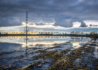
Visual documentation of the condition of a building before or after an event is an important tool in resolving insurance claims and disputes. It captures the extent of damage, the context of the location, and the overall condition of the building at a specific time. This approach is commonly used in the event of accidents, leaks, or technical failures.
The output is clear and time-specific visual documentation that can be used by insurance companies, lawyers and technical supervision. Instead of inaccurate descriptions, objective evidence is created. Documentation supports faster and more substantive resolution of situations without unnecessary disputes.
How do we deliver your data?
NIRA interactive platform
Working with NIRA
Survey data is valuable when it is clear, accessible and useful in practice. That is why we go beyond handing over files that disappear into emails or storage folders after a few days. We make survey results available online, giving clients an up-to-date view of the project, its progress over time and specific details on site. The data can be accessed from the office or the field, without specialist software.
In NIRA, visual records become a working tool rather than a passive image gallery. Teams can inspect details at high resolution, navigate the site and easily share views. In practice, the investor, project manager and site supervisor work with the same data and the same view of the actual conditions.
Why data delivery matters as much as the survey
On construction projects, the challenge is often how data is used, rather than its quality. Photographs and deliverables are scattered, lack context and are difficult to navigate. A digital workspace addresses this by organising the results chronologically and linking them to specific locations on site. Everyone involved can quickly find their bearings without lengthy explanations.
Continuity matters too. Data from successive stages remains accessible and comparable over time. This supports progress checks, dispute resolution and the retrieval of earlier information. The deliverables therefore serve as a long-term reference, as well as a record of a particular moment.
What this way of working gives you
A clear, shared overview – all deliverables in one place, organised and easy to understand.
Better communication – views and details are easy to share between investors, project management and site supervision.
Progress tracking – compare conditions at different project stages without searching for old files.
Practical value – data supports real decisions, as well as archiving.
Delivering data digitally in this format reduces confusion, saves time and increases the value of the survey itself. Clients receive a working tool that supports oversight, transparency and efficient project management. The following sections show how this data supports specific use cases and decision-making.
3D Models and the Sketchfab platform
Delivery of 3D models and data in various formats
Every project and every client has different requirements for how to work with 3D data. That is why we do not deliver reconstructed 3D models in just one "closed" form, but always according to what they are to be used for. We can provide the outputs as separate data files suitable for technical work, as well as visual models intended for presentation or sharing. The goal is for the data to fit into the client's existing processes, not to complicate them.
Depending on the assignment, we deliver 3D models, for example as point clouds, polygonal models or a combination of multiple outputs. Such data can be used in design software, BIM tools, geodetic applications or as a basis for further technical processing. The client thus gains full control over how and where to work with the data.
Online presentation and sharing of 3D models
In addition to technical data formats, we also offer the possibility of making 3D models available as an online tour. The model can be viewed directly in the browser, without the need to install specialized software. This method is particularly useful for presentations to investors, foreign partners or when communicating with management, where quick orientation and clarity are important.
Platforms like Sketchfab allow for interactive model exploration, rotation, zooming, and sharing of specific views. In practice, this means that a single model can serve both the technical team and management – each using it in a way that makes sense to them.
What flexible 3D data delivery really brings you
Usability for various professions – technical data for designers, clear models for investors.
Easy sharing – the ability to share the model internally and externally without complex setup.
Control over data – the client decides where and how the data will be further processed.
Long-term value - models serve not only for presentation, but also as a basis for further phases of the project.
The flexible delivery of 3D models ensures that reality reconstruction is not just a one-time output, but a long-term usable tool. The data is prepared to support decision-making, technical work and communication - exactly according to the needs of a specific project.
Photo documentation and orthophotography
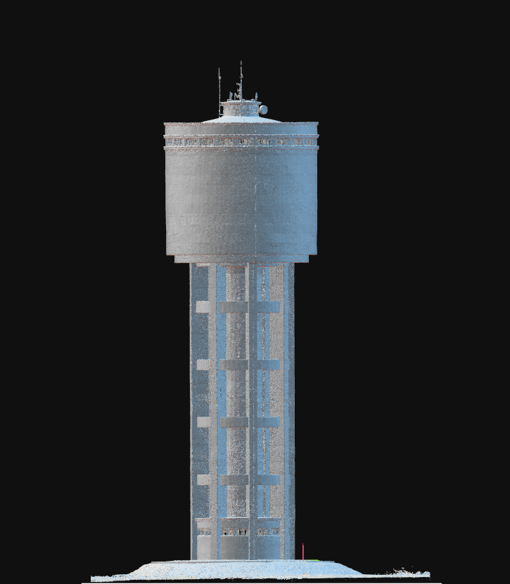

Delivery of photographs and orthophotogrammetry
Every project and client has different requirements for how to work with visual data. That is why we always deliver photographs and orthophotos according to their intended use. The outputs can be separate images suitable for technical inspection or clear orthophotogrammetries ready for measurements and comparisons of changes over time. The goal is for the data to fit into the client's existing processes and provide a clear, accurate and immediately usable basis.
We provide high-resolution, georeferenced, and scaled orthophotos based on your requirements. This data is ideal for designers, facility management, change documentation, or comparison of the status of facilities and areas. This gives the client complete control over how and where they work with the data.
Online access and sharing
In addition to individual files, we also offer the option of making photographs and orthophotogrammetry available for online viewing. The data can be viewed directly in a browser, without the need for special software, which facilitates presentations to management, investors or foreign partners.
What flexible visual data delivery brings you
Usability for various professions – accurate orthophotos for technicians, clear photos for management, and clear visualizations.
Easy sharing – internal and external data transfer without complications.
Control over data – the client decides where and how the data will be processed.
Long-term value - outputs serve not only for presentation, but also as a basis for further decisions and planning.
Flexible delivery of photographs and orthophotogrammetry ensures that visual documentation is not just a one-time output, but a long-term usable tool for preparation.
360 Virtual Tours
Delivery of 360° panoramic tours
For projects where complete visual orientation and the ability to “walk” through the space are key, we also provide 360° panoramic tours. Data can be obtained from aerial drone footage or from the terrain, depending on the nature of the object and the client’s requirements. Such tours allow you to interactively view the space, rotate views, zoom in on details, and gain a comprehensive impression of the object that conventional photographs or orthophotogrammetry cannot fully provide. This approach is particularly suitable for large or complex objects where visual orientation and the ability to analyze the space are critical, such as historical buildings, production halls, or large plots of land.
We work with various platforms such as Matterport, Kuula and others, always according to the specifics of the project and the client's needs. The platforms enable interactive tours with the ability to mark key points, add notes, measure distances and integrate into the client's existing processes. The outputs can be used for presentations to investors, communication with management, internal training or remote technical tours, saving time, reducing the need for physical visits and improving the decision-making process.
Benefits of 360° tours
Comprehensive visualization of space – allows you to virtually "walk around" and analyze every detail, including hard-to-reach or dangerous places.
Flexible sharing – tours are accessible online without the need for specialized software, allowing for easy sharing between internal teams, investors, or external partners.
Project customization – outputs are always tailored to the specific needs of the client and the nature of the object, whether it is an aerial view, ground inspection, or a combination of both.
Interactivity and functionality – the ability to add interactive notes, distance measurements, mark critical points, and integrate into existing design and engineering processes.
Long-term value – interactive tours serve not only for presentation, but also as a basis for maintenance planning, design, internal training or visualization of changes over time.
The flexible delivery of 360° panoramic tours ensures that visual documentation becomes a fully-fledged tool for decision-making, technical work and communication. Clients thus gain access to a tool that combines accuracy, visual clarity and interactivity, with outputs tailored precisely to the specifics of each project and the real needs of users.