

3D laser scanning: bringing an 1883 building to life

It started with a façade survey. It became a 3D model where today’s laser measurements meet drawings from 1883. Along the way, we gave the client an unexpected bonus: a view of the building in its wider context.
When undertaking a renovation, an architect needs to know which measurements to rely on. In this project, we used 3D laser scanning to create the basis for a façade model and to precisely separate the measurement data from the historical interpretation.
From laser scan to 3D façade model
We 3D laser scanned the façade from street and roof level and supplemented the survey with approximately 20 reference photographs. We processed, registered and merged the individual point clouds into a single dataset, then imported it into Rhino3D, our main modelling software, to create the 3D façade model.

The point cloud captures the geometry of the façade and forms the basis for its 3D modelling.
The result is a digital façade with centimetre-level accuracy according to our reference check measurements. It captures the surveyed geometry and provides a basis for further design work.
Unexpected bonus: drawings from 1883
Shortly before completion, we decided to offer the customer something special.
We found drawings of this property dating from 1883 in the historical archives. Based on these drawings, we modelled the rest of the building and placed the façade within a broader architectural context. This added section is an interpretation of historical sources and does not possess the same verified accuracy as the scanned façade.

The measured façade is shown in the context of the entire building. The interior and the other added areas are based on the interpretation of historical drawings and are not a verified as-built survey.
Advantages for architects and project developers
This is where building digitisation opens up more possibilities. Depending on the survey scope and level of detail, the data can support elevations and sections, façade refurbishment design, quantity take-offs, visualisations and further BIM modelling. An interactive 3D model also helps architects, owners and investors understand one another when making decisions about a building.
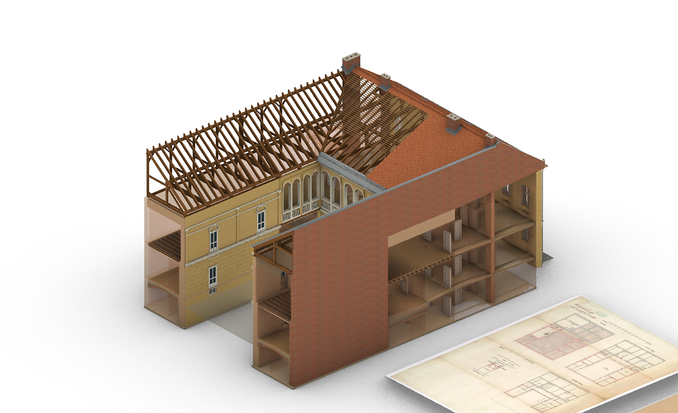
The view into the courtyard and of the exposed roof truss illustrates the design possibilities. The added geometry is based on the interpretation of archival documents from 1883.
One survey can support many deliverables. Its value lies in turning the data into information your project actually needs.
Planning a refurbishment or missing up-to-date building documentation? Send us a photograph of the property and tell us what you need to design or verify. We will help you define the survey scope and the deliverables you need.
Comments